Call Us: +1 866 300 9012

contact@measur.ca
SHOPPING CART

No Products in the Cart

TOTAL:
$0.00

A Close Look at the Heavy-Lift Capabilities of the IF1200

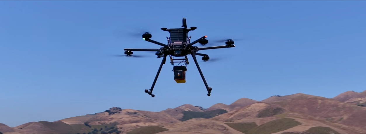
In many advanced applications, such as high-precision mapping, projects often demand specific equipment that heavier LiDAR systems offer, like the YellowScan Voyager. These sophisticated systems require drones capable of carrying substantial payloads, which is where heavy-lift drones come into play. The 
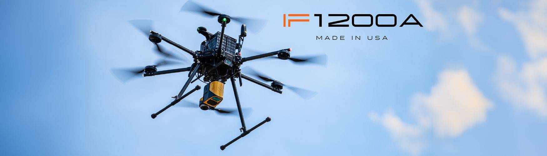
Inspired Flight IF1200A is designed to meet this need, offering the capacity to handle not only heavy LiDAR systems but also other integrated payloads, such as Ground Penetrating Radar (GPR) sensors and delivery systems. This capability ensures that the IF1200A can support a wide range of applications, delivering the versatility and performance required for demanding projects.

Additionally, the IF1200A is a Blue UAS, which means it meets the stringent standards set by the Blue UAS program. This certification ensures that the drone complies with security and performance requirements essential for government and critical infrastructure use. Blue UAS drones undergo a thorough vetting process by the United States Department of Defense. This rigorous evaluation includes stringent checks on secure software, reliable manufacturing practices, and a strong emphasis on data integrity.

What Sets the IF1200 Apart

The Inspired Flight IF1200A stands out in the drone market due to its exceptional performance, advanced features, and adaptability for heavy-lift tasks. Here’s a closer look at what makes the IF1200A unique:

High Performance and Versatility

The Inspired Flight IF1200A is engineered for impressive performance with its vertical capabilities, featuring a maximum flight time of 43 minutes, the IF1200A enables extended missions without frequent recharging or swapping of batteries. It offers a maximum ascent speed of 5 m/s (16 ft/s) and a descent speed of 2.5 m/s (8.2 ft/s). This allows for rapid adjustments in altitude, enhancing operational efficiency. The drone's top air speed of 25 m/s (56 mph) enables it to cover extensive areas quickly, making it well-suited for time-sensitive tasks. It is built to withstand challenging weather, with resistance to winds up to 12 m/s (23 knots) and gusts reaching 15 m/s (29 knots). Moreover, the IF1200A operates reliably across a wide range of temperatures from -20°C to 45°C (-4°F to 113°F) and humidity levels from 10% to 95%.

Exceptional Payload Capacity

The heavy-lift drone is designed to handle substantial payloads with a maximum capacity of 19.1 lbs (8.7 kg). This capability allows it to carry advanced and heavy equipment, such as high-end LiDAR systems and specialized sensors, expanding its versatility for various applications. The drone's operational flexibility is evident in its service ceiling, which varies based on the payload. It can reach altitudes of up to 3.9 km (12,800 ft) when carrying a 4 kg payload and operates at a ceiling of 2.2 km (7,200 ft) with a full 8.7 kg payload.

Advanced Flight Stack

The Inspired Flight IF1200A  features the advanced CubePilot Cube Blue H7 flight controller, paired with triple redundant IMUs, ensuring top-notch flight control by continuously monitoring and compensating for any variations. The drone's dual CubePilot Here3 M8P GNSS systems provide accurate positioning and navigation, enhancing its ability to perform complex tasks with precision. It also supports a range of voltage options (5V, 12V/15V, 18V, 44.4V) through its versatile power rails, allowing it to efficiently power a variety of payloads. This combination of high-precision control, accurate navigation, and adaptable power options makes the IF1200A well-suited for demanding missions and diverse payload integrations.

Various Flight Modes

• Position Hold and Loiter: These modes provide stable altitude and position control, allowing for precision manual movements and automated mission execution.

• Auto and RTL: Pre-defined waypoint missions and auto-return-to-takeoff-location functions enhance mission planning and safety.

• Altitude Hold: Maintains altitude even if GPS signal is lost, ensuring reliable operation in GPS-denied environments.

RELATED POSTS

How to Select the Best Drone-Based Ground Penetrating Radar
Ground Penetrating Radar (GPR) technology has transformed how we explore and understand what's beneath the surface, making it an essential...
What Makes the YellowScan Voyager a Unique Drone-Based LiDAR System
The YellowScan Voyager is not just another LiDAR system; it's a cutting-edge solution that stands out in the industry for...
Best Commercial Drones of 2024
The commercial drone industry is evolving rapidly, with 2024 showcasing some of the most advanced and versatile models yet. From...

Get in touch

Give us a call or drop by anytime, we will answer all enquiries within 24 hours on business days. We will be happy to answer your questions.

Contact Information

We would love to hear from you! Our team is always here to help.

  • +1 866 300 9012

  • contact@measur.ca

  • Vancouver, British Columbia

    Calgary, Alberta

    Mississauga, Ontario

    Montreal, Quebec

Name*:

Phone*:

Email*:

Message:

BACK TO TOP