No Products in the Cart

Augmented reality (AR) overlays enhance live video feeds by adding critical contextual information, such as street names and addresses, which significantly improves situational awareness. This additional layer of detail allows for precise location pinpointing and better coordination during responses, making it easier to navigate and address specific areas of interest efficiently.
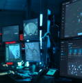
LiveOps scales to the mission by allowing you to manage and view multiple drone streams simultaneously. Streams from all connected drones automatically populate on your LiveOps dashboard, where you can easily rearrange and prioritize feeds to focus on the most critical areas.
The Drone Response Center in LiveOps provides a comprehensive overview of your jurisdiction, enabling efficient management of city-wide deployments. You can view all operational drones within your area, receive real-time notifications about incidents and service requests, and select from available deployment stations to dispatch drones rapidly. This centralized control ensures that you have the necessary tools to coordinate and manage drone operations effectively across your entire service area.

LiveOps integrates seamlessly with your existing technology infrastructure:
CAD & RTCC: Connect with computer-aided dispatch and real-time crime centers for efficient operations.
Evidence Management: Integrate with evidence management systems and other relevant technologies to streamline data flow and usage.

LiveOps ensures safe drone operations through comprehensive airspace awareness features. By integrating ADS-B, ground-based radar, and weather data, the platform helps you avoid airspace conflicts and maintain operational safety. Additionally, LiveOps automatically adjusts drone flight paths in real time based on this data, ensuring that your drones navigate safely, even in complex or changing conditions.

With LiveOps, you can access and analyze LiDAR map data in real-time, enhancing your operational capabilities. As the drone flies, maps are continuously updated to provide the most current information available. Additionally, LiveOps offers the ability to convert 3D maps into 2D floorplans, making it easier to interpret and utilize the data for various applications and detailed analysis.


Give us a call or drop by anytime, we will answer all enquiries within 24 hours on business days. We will be happy to answer your questions.
We would love to hear from you! Our team is always here to help.
+1 866 300 9012
contact@measur.ca
Vancouver, British Columbia
Calgary, Alberta
Mississauga, Ontario
Montreal, Quebec