No Products in the Cart
Drones offer efficient and cost-effective solutions for energy and utility inspections, enhancing safety, accessibility, and data collection capabilities.
Drones can cover large areas quickly and efficiently, minimizing man-hours, and equipment, needed during inspection activities.
Drones eliminate the need for human inspectors to physically climb towers, navigate through challenging terrain, or enter confined spaces, reducing the risk of falls, electrocution, or exposure to hazardous environments.
Collected data provides comprehensive insights into the condition of assets, including signs of corrosion, wear and tear, loose connections, hotspots, and other anomalies.

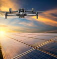
Challenges in inspecting solar panels involve time-consuming manual inspections where workers must physically examine each panel, often in hard-to-reach places like rooftops or remote areas. This not only poses safety risks but can also be costly and inefficient.


Traditional wind turbine inspections are risky, time-consuming, and costly. Technicians face safety hazards scaling towers, weather delays, and limited access to critical components; drones offer a safer, faster, and more cost-effective alternative, bypassing these challenges with ease.
Using drones to inspect turbines offers a cost-effective, efficient, and safe alternative to traditional methods. They streamline operations, reduce downtime, and optimize energy production while ensuring personnel safety by eliminating hazardous climbs.
The pairing of the DJI Zenmuse H20T payload with the DJI Matrice 350 RTK offers a robust solution for wind turbine inspections. The M350 RTK provides stable and precise flight performance with extended flight time, while the H20T payload offers versatile imaging capabilities, including optical zoom, thermal imaging, and a laser rangefinder. This combination allows inspectors to efficiently capture visual and thermal data, detect anomalies, and measure distances accurately during wind turbine inspections, ensuring the integrity and maintenance of these critical assets.
Find the perfect solution for your needs.

Drones can autonomously inspect power infrastructure along predefined flight paths and navigate complex environments, such as wind farms, while avoiding obstacles and maintaining safe distances from structures. This reduces the need for manual piloting, improving inspection efficiency and cost-savings.

Drones equipped with LiDAR or photogrammetry can conduct aerial surveys of power infrastructure with precision and speed. These surveys generate detailed 3D models, or point clouds, of power lines, towers, and substations, allowing for accurate assessments of structural integrity.

Drones equipped with thermal cameras can detect anomalies in power equipment such as overheating components, faulty connections, or insulation defects. Thermal imaging surveys enable early detection of potential failures, helping companies prioritize maintenance activities.

Drones enable remote inspection of power infrastructure, allowing inspectors to assess equipment from a safe distance. This is beneficial for inspecting equipment located in remote or inaccessible areas, such as offshore wind farms or mountainous terrain

Traditional pipeline inspections face numerous challenges, including limited accessibility, rugged terrain, safety risks to personnel, time-consuming manual processes, and incomplete coverage of pipeline infrastructure. Conventional methods often rely on ground-based inspections or manned aircraft surveys, which can be costly and inefficient, leading to delays in identifying and addressing pipeline defects or leaks.
Drones are utilized for pipeline inspections by employing high-resolution cameras for visual assessments, thermal imaging to detect temperature anomalies indicative of leaks or faults, and LiDAR technology for creating precise 3D models of pipelines and surrounding terrain. Their ability to access challenging terrain ensures comprehensive coverage, while automated flight routes and data analysis software streamline operations, providing valuable insights for maintenance planning.
Trinity Pro is built for long-range missions, making it an ideal choice for pipeline inspections across expansive areas. With a maximum range of 100 km or 700 hectares, it can cover vast stretches of pipeline infrastructure in a single flight, minimizing the need for multiple take-offs and landings. Its vertical take-off and landing (VTOL) capabilities allow for deployment in any terrain without the need for a runway, while its extended flight time of 90+ minutes and wind tolerance of 18 m/s ensure coverage even in challenging conditions. Additionally, the Trinity Pro's robust design and integrated LiDAR scanner guarantee reliable performance and highly accurate data collection, setting a new standard for high-accuracy survey equipment.

Inspecting substations is not an easy task. Manual inspections can be time-consuming and physically demanding, requiring inspectors to navigate through complex environments. Sometimes, relying solely on visual inspections might mean they miss subtle issues, which could potentially cause equipment failures or safety concerns down the line.
Drone substation inspections offer fast, safe, and detailed assessments of electrical infrastructure. Equipped with high-resolution cameras and sensors, drones efficiently identify potential issues, reducing downtime and optimizing maintenance schedules. By accessing hard-to-reach areas quickly and without disruption to operations, drone inspections enhance safety, reliability, and cost-effectiveness, ensuring the integrity of critical infrastructure.
The Share 100M PRO camera is a game-changer for drone substation inspections, as it offers unparalleled accuracy and efficiency. Seamless integration with the DJI Matrice 350 RTK, means that the Share 100M Pro enables inspectors to capture even the tiniest details with its 102 MP resolution and realistic 3D modelling capabilities. With fast data processing and a lightweight design optimizing flight time, the Share 100M PRO facilitates fast and comprehensive inspections, while its high-performance sensor ensures exceptional image quality even in challenging lighting conditions.

Traditional methane emissions monitoring methods face several obstacles, such as labour-intensive manual inspections, which are often sporadic and can overlook fugitive leaks, resulting in underestimated emissions. Moreover, relying heavily on stationary monitoring stations may fail to capture emissions in diverse industrial settings accurately.


The DJI Dock is a good choice for automated drone inspections due to its ruggedness, reliability, and round-the-clock operation capabilities. Each DJI Dock accommodates a Matrice 30 drone, which can land, recharge, take off, and execute programmed missions using DJI FlightHub 2. The DJI Dock is easy to install and deploy, allowing for efficient automation of inspection tasks.
Cloud Management: Operators can manage missions, plan flight routes, and handle data collection remotely via FlightHub 2, enabling real-time awareness and efficient mission planning.
Fast Charging: The TEC air conditioning system enables rapid charging of drone batteries, from 10% to 90% in just 25 minutes, ensuring minimal downtime.
Industrial Strength: DJI Docks are built to withstand harsh environmental conditions, operating within a wide temperature range and providing surge protection.
Wide Area Coverage: The Matrice 30 drone can conduct inspections up to 7 km away from the dock, equipped with cameras and sensors to capture necessary aerial data.

Unmanned Ground Robots play a pivotal role in inspecting energy and utilities assets by transforming traditional inspection methods. Taurob's ground-based robots offer versatility and objectivity in data collection, navigating challenging terrain and overcoming obstacles with ease. Equipped with precision sensors and certified for hazardous environments, such as explosive atmospheres and extreme temperatures, the Inspector Robot ensures safety while conducting thorough inspections. Its ability to capture high-definition images, identify gas leaks, and survey surroundings in 3D enhances the efficiency and accuracy of maintenance tasks. By minimizing human intervention and maximizing data accuracy, robotics inspection and maintenance streamline operations, reduce downtime, and ultimately improve the reliability and longevity of critical power equipment.
Data Gathering Expertise: Equipped with precision sensors, the Inspector robot captures high-definition photos and videos, records sounds, identifies gas leaks through thermography, and surveys its surroundings with a 3D LIDAR scanner.
ATEX Certified: Certified for use in explosive environments (ATEX and ICEx certified), the Inspector prioritizes safety. It can operate in extreme temperatures ranging from -20°C to +60°C, ensuring functionality in harsh conditions.
Integration in Software Systems: The robot seamlessly integrates with software systems, allowing for easy remote mission settings via an app over WiFi, LTE, or 4G connections.

Whether you need one-on-one or group training, our training programs provide the latest practical knowledge while keeping your budget in mind.
Looking to rent a drone to meet your evolving drone needs?
You'll find a wide range of industry-leading equipment, from DJI drones to advanced LiDAR systems at Measur. We offer cost-effective and convenient solutions for accessing high-quality drone technology without the commitment of ownership.

Give us a call or drop by anytime, we will answer all enquiries within 24 hours on business days. We will be happy to answer your questions.
We would love to hear from you! Our team is always here to help.
+1 866 300 9012
contact@measur.ca
Vancouver, British Columbia
Calgary, Alberta
Mississauga, Ontario
Montreal, Quebec