+1 866 300 9012   contact@measur.ca
SHOPPING CART

No Products in the Cart

TOTAL:
$0.00

Finding the Best Fixed-Wing VTOL Drone for Intensive Mapping Projects

Fixed-wing drones have taken the mapping world by storm, offering professionals a game-changing tool for efficient and precise aerial data capture. As these innovative devices continue to redefine industry standards, understanding their technology, applications, and advantages becomes essential for anyone involved in intensive mapping projects. In this article, we explain the basics of fixed-wing drones, explore their diverse applications across various sectors, and compare their performance to rotary-wing drones. We'll also provide insights on key features to consider and essential factors to keep in mind when investing in a fixed-wing drone for your next big project.

The Basics of Fixed-Wing Drone Technology

Fixed-wing drones are unmanned aerial vehicles (UAVs) that resemble miniature airplanes. Unlike their rotary-wing counterparts, which rely on multiple rotors for lift and maneuverability, fixed-wing drones generate lift with their wings, enabling them to cover larger areas in a single flight.

These drones typically feature a rigid structure, consisting of a lightweight airframe and a powerful propulsion system. By utilizing motorized propellers or jet engines, fixed-wing drones achieve sustained horizontal flight, allowing them to capture high-resolution imagery over extensive terrain.

Fixed-Wing vs. Rotary-Wing Drones

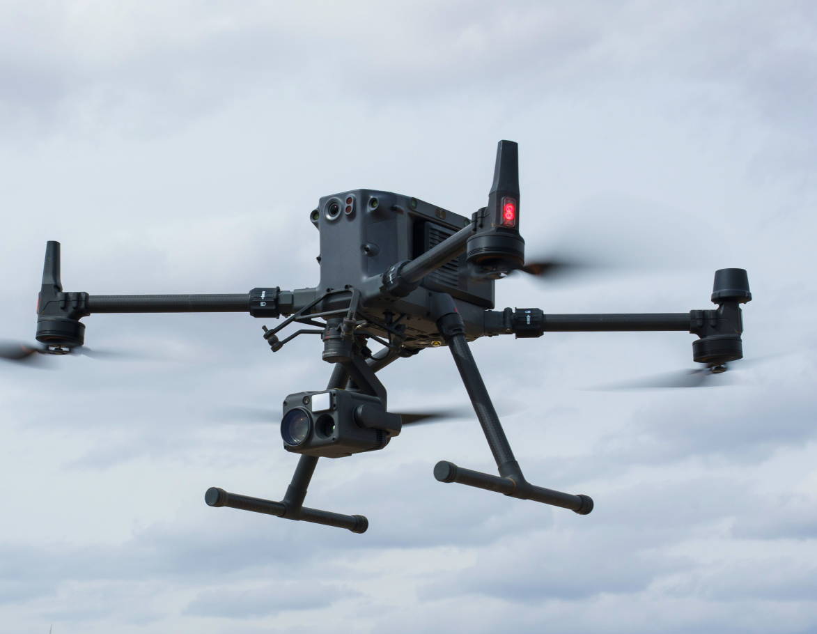
While fixed-wing drones excel in covering large areas, their maneuverability in tight spaces is limited compared to rotary-wing drones. Rotary-wing drones, such as quadcopters, offer enhanced agility, making them ideal for tasks like inspection, and public safety.

However, the advantage of fixed-wing drones lies in their ability to fly longer distances, making them perfect for mapping projects that require extensive coverage. Their efficient flight characteristics also enable them to accommodate advanced sensors and cameras for high-quality data acquisition.

When it comes to efficiency, fixed-wing drones outperform rotary-wing drones in terms of flight endurance and speed. Fixed-wing drones can remain airborne for hours, covering large areas without frequent battery swaps or recharging. This endurance enables professionals to complete mapping projects efficiently, saving time and resources.

Furthermore, the speed of fixed-wing drones allows them to complete missions quickly, reducing the time spent in the field. Rotary-wing drones, while more agile, often require multiple flights to achieve the same level of coverage, increasing project duration and costs.
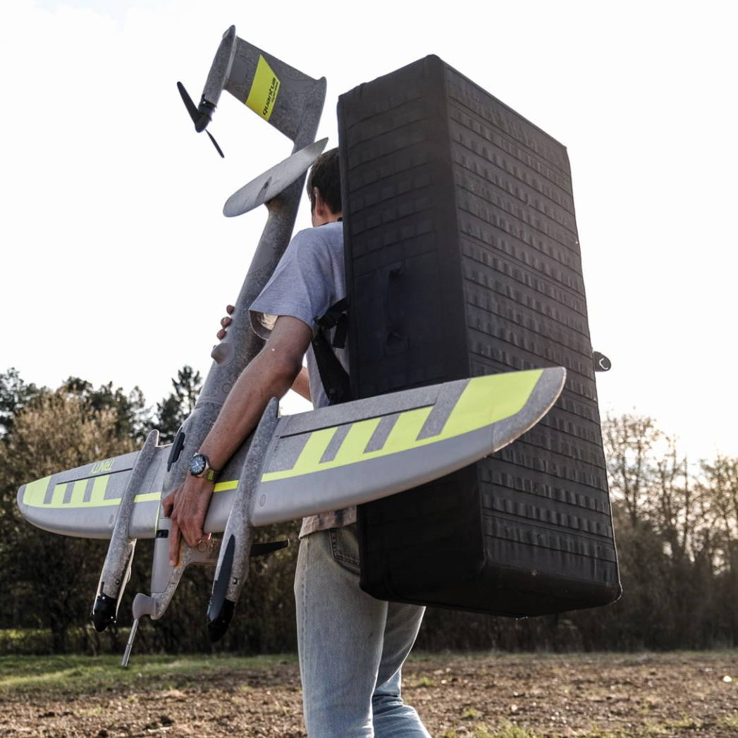
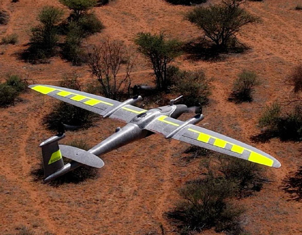
Fixed-Wing VTOL Drone: Trinity Pro
Quadcopter: DJI M350 RTK

The Impact of Fixed-Wing Drones in Various Industries

The integration of fixed-wing drones in industries such as agriculture, construction, and environmental management has had a transformative impact. These drones provide professionals with comprehensive and up-to-date data, enabling them to make informed decisions and streamline operations. The accuracy and efficiency of fixed-wing drones have elevated them from recreational devices to indispensable precision tools.
Agriculture: Farmers are using fixed-wing drones to conduct detailed aerial surveys of their crops. By capturing high-resolution images and generating NDVI (Normalized Difference Vegetation Index) maps, they can monitor crop health, identify areas of stress or disease, and optimize irrigation and fertilization schedules. For instance, a vineyard might use drone data to manage water resources more efficiently, resulting in healthier vines and improved grape quality.

Construction: In construction, fixed-wing drones are revolutionizing site surveys and progress monitoring. They can quickly cover large construction sites, capturing detailed topographic maps and 3D models. This data is invaluable for planning and tracking the progress of projects. For example, a construction company building a new highway might use drone-generated maps to ensure that earthworks are proceeding according to plan, minimizing delays and cost overruns.

Environmental Management: Environmental agencies employ fixed-wing drones for tasks such as wildlife monitoring, forest mapping, and assessing the impact of natural disasters. These drones can cover vast areas quickly, providing critical data for conservation efforts and disaster response. For example, after a forest fire, drones can be used to map the extent of the burn area and identify regions that need urgent reforestation efforts, thus speeding up recovery and restoration processes.

Key Features to Look for in a Fixed-Wing Drone for Professional Use

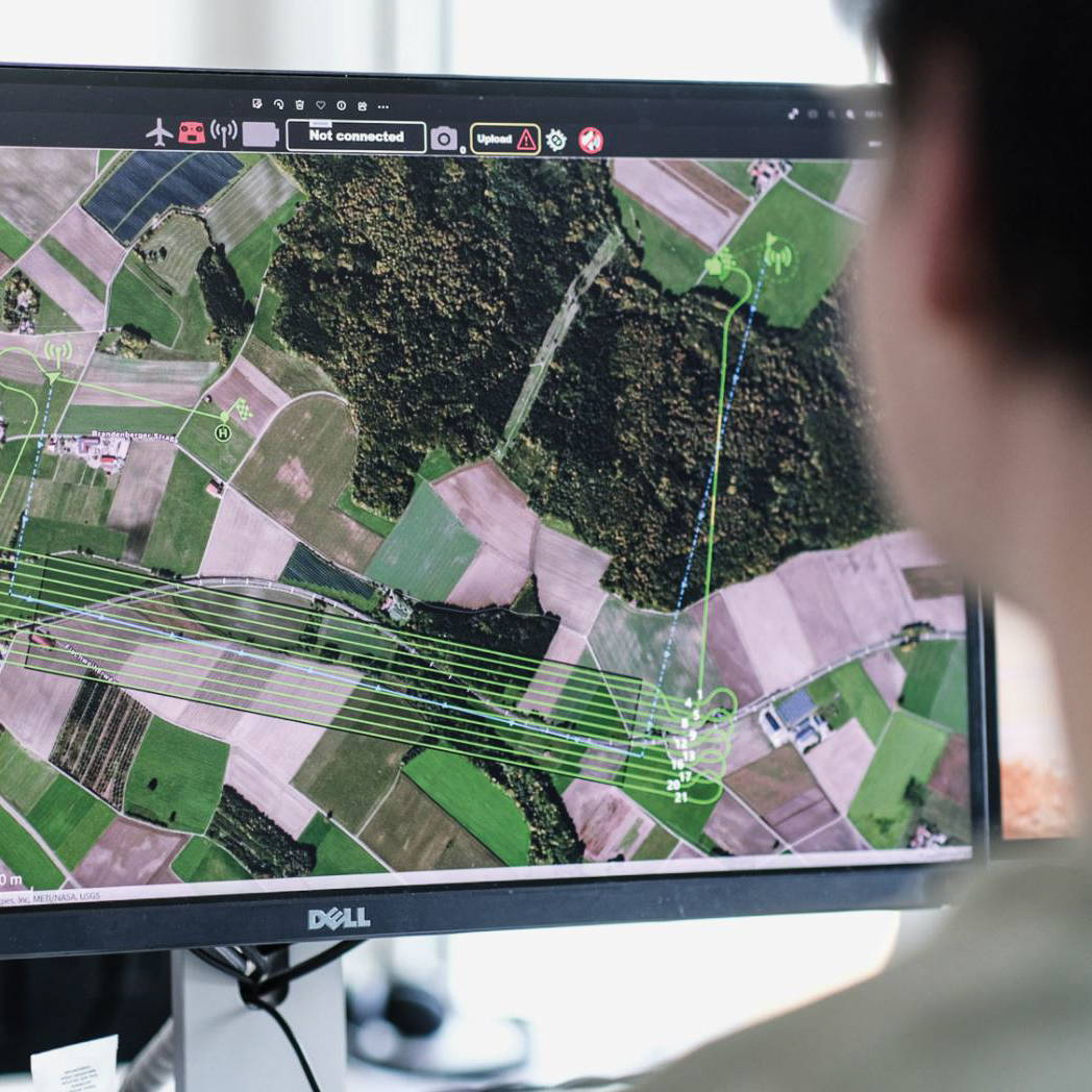
When investing in a fixed-wing drone for professional use, essential features include a reliable autopilot system for autonomous flight, precise navigation, and the ability to execute complex missions with mapping software for optimum coverage and data collection. High-quality camera or sensor payloads, real-time data transmission, and intelligent flight control systems enhance operational efficiency and provide immediate insights for on-site decision-making.
The Trinity Pro, a next-generation e-VTOL fixed-wing mapping drone, exemplifies these features with its Quantum-Skynode autopilot, Linux mission computer, and seamless integration with advanced cameras and AI tools. Its VTOL capability ensures easy and safe handling, while the enhanced terrain-following system and automatic wind simulation improve safety and data quality. With a flight time of 90 minutes, the ability to cover 700 hectares, and advanced PPK GNSS for precise data accuracy, the Trinity Pro is a leading fixed-wing drone for mapping and surveying efficiency.

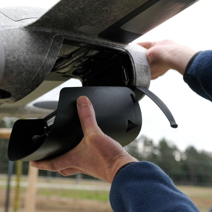
Moreover, the Trinity Pro offers a diverse range of payload options, each designed to meet specific surveying and mapping needs. Here are the payload options available for the Trinity Pro:

Oblique D2M: Five-lens RGB camera with 1 NADIR and 4 oblique cameras.
Sony UMC-R10C: APS-C 20.1 MP camera.
RedEdge-P: 5 spectral band sensor.
Sony RX1RII: Full-frame 42 MP camera.
Micasense Altum-PT: 5 spectral bands and a thermal sensor.
Qube 640 LiDAR: Survey-grade LiDAR payload.

This extensive range of payloads makes the Trinity Pro unique in its class, offering advanced versatility and capability for various professional applications.
Sale Off
Qube 640
Sale Off
Phase One P5
Sale Off
Sony ILX LR1
Sale Off
RX1RII
Sale Off
Sony UMC-R10C

Essential Factors to Consider Before Investing in a Fixed-Wing Drone

Investing in a fixed-wing drone is a significant decision that requires careful consideration of various factors to ensure it meets your specific needs and project requirements. Below are key elements to evaluate before making a purchase:

1. Drone Specifications

• Flight Range and Endurance: Assess the drone's maximum flight range and endurance to ensure it can cover the necessary distances and duration for your operations.
• Payload Capacity: Determine the payload capacity to confirm it can carry the required sensors, cameras, or other equipment needed for your missions.
• Speed and Altitude: Consider the drone's maximum speed and operational altitude to match the requirements of your applications.
• Weather Resistance: Ensure the drone can withstand the environmental conditions it will be exposed to, such as wind, rain, or extreme temperatures.

2. Pricing and Budget

• Initial Cost: Compare prices across different models and brands to find a drone that fits your budget while meeting your specifications.
• Operational Costs: Factor in the cost of batteries, spare parts, and other consumables. 
• Insurance: Investigate the cost and availability of insurance for the drone, especially if it will be used for commercial purposes.

3. Regulatory Compliance

• Local Regulations: Ensure the drone complies with local aviation regulations and obtain any necessary permits or licenses.
• Safety Standards: Verify that the drone meets industry safety standards and guidelines.

4. Technical Expertise and Training

• Ease of Operation: Evaluate the complexity of the drone’s operation and whether your team has the necessary technical skills.
• Training Requirements: Consider the availability and cost of training programs to ensure safe and efficient operation of the drone. Measur offers comprehensive customer support and drone trainingto help you get started and stay proficient.

5. Maintenance and Support

• Ease of Maintenance: Assess how easy it is to maintain and repair the drone, including the availability of spare parts and repair services.
Look for manufacturers or suppliers that offer robust customer support, including technical assistance. Measur provides extensive customer support to ensure your drone operates smoothly and efficiently.

6. Brand Reputation and Track Record

• Reputable Brands: Invest in drones from reputable brands with a proven track record in the industry. This can provide confidence in the quality and reliability of the product.
• User Reviews and Case Studies: Read user reviews and case studies to gather insights into the drone’s performance in real-world scenarios.

7. After-Sale Services

• Warranty: Check the warranty terms to understand what is covered and for how long.
• Software and Firmware Updates: Ensure the manufacturer provides regular updates to improve the drone’s performance and security.

By thoroughly evaluating these factors, you can make an informed decision and select a fixed-wing drone that best suits your operational needs and ensures a successful investment.

RELATED POSTS

Guide: Integrating the BRINC Responder into First Responder Operations
In the fast-paced emergency response environment, having the right tools can significantly impact the effectiveness of operations. The BRINC Responder,...
Measur Signs Canadian Distribution Agreement with BRINC Drones
October 7th, 2024 - Measur, Canada's leading unmanned systems distributor, and BRINC Drones, a leader in public safety technology, today...
Why the DJI Mavic 3 Thermal is Essential for Public Safety Teams
Compact, powerful and equipped with advanced thermal imaging technology, the DJI Mavic 3 Thermal is built to assist in critical missions...

Get in touch

Give us a call or drop by anytime, we will answer all enquiries within 24 hours on business days. We will be happy to answer your questions.

Contact Information

We would love to hear from you! Our team is always here to help.

  • +1 866 300 9012

  • contact@measur.ca

  • Vancouver, British Columbia

    Calgary, Alberta

    Mississauga, Ontario

    Montreal, Quebec

Name*:

Phone*:

Email*:

Message:

BACK TO TOP