+1 866 300 9012   contact@measur.ca
SHOPPING CART

No Products in the Cart

TOTAL:
$0.00

Written by: Maria Zavarce

Contributor: Lukas Wilgosh 

Guide to the Top 2 Confined Space Drones: Scout 137 Drone System and Flybotix ASIO X

November 12, 2024

8 minutes read

In heavy industry, the inspection of confined spaces like tanks, boilers, pipes, and ducts is essential for asset integrity and operational safety. Traditionally, these spaces required human inspectors to navigate cramped, often hazardous conditions, risking exposure to limited oxygen, toxic atmospheres, and structural instability. Confined space drones have transformed this process by providing a non-invasive, highly accurate means of gathering real-time data, improving both safety and efficiency.


These drones are built with specific technical features tailored for industrial inspection in GPS-denied environments. Advanced sensors and onboard SLAM (Simultaneous Localization and Mapping) algorithms enable precise navigation while high-resolution cameras, LiDAR sensors and bright LEDs help capture essential visual data. Confined space drones streamline inspection by eliminating the need for scaffolding, ventilation setups, and manual entry, saving valuable time and resources.

This guide explains two leading drones in this niche the Scout 137 Drone System and the Flybotix ASIO X, analyzing their technical specifications, performance, and best-use scenarios to help you make an informed decision.

Scout 137 Drone System

Technical Specifications

  • Dimensions: 613mm × 382mm × 303mm (L×W×H)
  • Weight: 3.2 kg
  • Camera Resolution: 4K (3840 x 2160) @ 30 fps
  • Lighting Intensity: Over 10,000 lumens
  • Gimbal: 2-axis stabilized; ±90° pitch
  • Power Source: Tethered with unlimited flight time
  • Navigation: 3D LiDAR for SLAM-based mapping and positioning
  • Tether Length: 40 meters, optimized for confined spaces
  • Data Management: Cloud-based Scout Portal with SLAM-enabled 3D point cloud mapping.

Unlimited Tethered Power

The Scout 137’s tethered system provides continuous power, removing the typical flight time limitations of battery-operated drones. The tether’s high cut resistance and flame-retardant, halogen-free coating enhance durability, especially when the drone maneuvers around sharp edges or metal beams. This tether is a critical advantage for extensive inspections, as it allows uninterrupted operation and direct, stable data transmission.

Advanced SLAM & 3D LiDAR Mapping

Equipped with a high-resolution 3D LiDAR, the Scout 137 generates SLAM-based maps of its environment, enabling it to autonomously stabilize and position itself in low-light, GPS-denied spaces. This mapping supports real-time location tagging of inspection data, a major benefit for inspecting complex structures where precision is paramount.

Lighting and Stabilized Camera

The Scout 137 drone is purpose-built for confined space inspections, offering a powerful combination of lighting and a stabilized 4K camera for detailed visual data. Its gimbal-stabilized camera ensures steady footage, while onboard LEDs provide exceptional illumination in low-light environments. These features make the Scout 137 an indispensable tool for industrial inspections in hazardous spaces, enabling accurate data collection, live Full HD streaming, and seamless cloud-based management via the Scout Portal.

Cloud-Based Data Platform: Scout Portal

The Scout Portal supports live data streaming, 3D mapping, and post-inspection review. By leveraging SLAM data, users can create a 3D point cloud of the inspection site, providing a digital record that can be annotated and customized with points of interest (POIs). The platform also supports data upload from other inspection tools, enabling a unified inspection dataset.

Flybotix ASIO X

Technical Specifications

  • Dimensions: Compact, enclosed twin-rotor design
  • Weight: Lightweight (under 2 kg)
  • Camera Resolution: Full HD video streaming
  • Lighting: Industry-leading 40K lumens for powerful visibility
  • Flight Time: 20 minutes (untethered)
  • Navigation: Acoustic positioning for GPS-denied environments, with gyro-stabilization
  • Power Source: Battery-operated
  • Propulsion: Coaxial dual-rotor propulsion system for enhanced stability

Coaxial Rotor System for Stability and Agility 

The ASIO X features a unique coaxial dual-rotor design, which reduces rotor drag and enhances stability in confined, often turbulent spaces. This design minimizes the need for multiple propellers, enabling more compact dimensions and making it easier to navigate tight spaces and complex geometries. This rotor configuration also allows quieter operation, reducing noise in enclosed spaces.

Battery-Operated Flexibility

Unlike the Scout 135’s tethered setup, the ASIO X relies on a high-density battery for power, offering a maximum flight time of 20 minutes per charge. This battery configuration provides greater maneuverability in spaces where tethers may be challenging to manage. The ASIO X’s battery system is ideal for quick, localized inspections that require agility over prolonged operation.

Acoustic Positioning for GPS-Denied Navigation

Specifically designed for GPS-deprived environments, this technology uses acoustic signals to deliver precise navigation and stability, even in the most challenging conditions. Ideal for industrial tanks, pipelines, and wind turbine blades, the ASIO X pairs this innovation with a robust LiDAR and sensor suite to ensure safe, efficient, and highly accurate inspections.

Compact Design and Protective Frame

Designed for maximum portability, the ASIO X’s protective frame allows it to bounce off obstacles without damage, maintaining operational integrity even in challenging environments. This feature enhances its robustness, especially in environments with pipes, beams, and obstructions. This compact build also makes the ASIO X highly maneuverable, ideal for smaller spaces where larger drones cannot operate effectively.

Comparative Analysis

Feature Scout 137 Drone System Flybotix ASIO X
Flight Duration Unlimited (tethered power). 20 minutes (battery-powered).
Navigation & Positioning Uses 3D LiDAR with SLAM for mapping and obstacle detection. LiDAR for 3D mapping in GPS-denied spaces.
Camera 4K camera with adjustable gimbal. Full HD and thermal cameras.
Lighting 10,000+ lumens. 40,000 lumen output for exceptional visibility.
Data Transmission Tethered data link with live streaming. Wireless 2.4GHz/5GHz link; Flybotix Cloud compatible.
Tether Length 40 meters, durable and visible tether. Not applicable (untethered).
Ground Station Provides power, tether connection, and data relay. Portable control unit without a ground station.
Gas Detection Payload Gas sensor detects most common flammable gases and vapors Sensors for CH4, H2S, O2, and CO gas detection.
LiDAR Mapping System LiDAR with SLAM for real-time mapping. LiDAR for 3D mapping and localization.
Operational Flexibility Continuous inspection, no battery limits (tethered). Flexible battery-powered, requires recharging.
Inspection Data Management Scout Portal for data management and reporting. Flybotix Cloud for data storage and analytics.
Safety Enhancements Redundant systems, safe for hazardous sites. Compact, untethered design with gas sensors for safety.
Target Industries Oil & Gas, Infrastructure, Power, Marine, Chemical. Chemical, Utilities, Oil & Gas, Manufacturing.
Environmental Ratings IP54 dust and splash resistant. IP55 rated for dust and moisture resistance.
Dimensions 613 mm x 382 mm x 303 mm. 395 mm x 395 mm x 170 mm.
Weight 3.2 kg. 1.3 kg.

Which Drone is Right for Your Needs?

Scout 137 Drone System is best suited for long, detailed inspections in complex or large confined spaces. The tethered power allows for uninterrupted operation, and the 3D LiDAR and SLAM mapping make it ideal for capturing detailed structural data, creating 3D maps, and marking specific points of interest.


Flybotix ASIO X is ideal for quick inspections in compact areas where maneuverability is key. Its coaxial rotor design allows it to easily navigate confined spaces and bounce off obstacles without significant damage, making it a great choice for routine inspections.


Both drones are powerful tools for confined space inspection, each designed to meet specific operational needs in industrial environments. The Scout 137 drone system excels in data richness and endurance, while the Flybotix ASIO X brings agility and compactness to areas otherwise unreachable.

Get in Touch

Give us a call or drop by anytime, we will answer all enquiries within 24 hours on business days. We will be happy to answer your questions.

About the Author

Maria Zavarce, Marketing Coordinator at Measur, brings over two years of specialized experience in the drones and robotics industry. Combining her knowledge of emerging technologies with 8+ years of inbound marketing and SEO, she provides actionable insights into the transformative power of advanced solutions.

YOU MAY ALSO LIKE

Bathymetric surveys, which involve mapping the underwater topography of lakes, rivers, oceans, and other bodies of water, have historically been conducted using traditional manned boats equipped with sonar systems. While effective, these methods can be time-consuming, expensive, and sometimes risky, especially in shallow, remote, or hazardous waters. However, drones or unmanned aerial vehicles (UAVs) and unmanned surface vessels (USVs) are facilitating bathymetric surveys by offering a faster, more efficient, and safer alternative.

What is a bathymetric survey?

A bathymetric survey measures the depth and topography of the underwater surface, providing a detailed map of the waterbed. These surveys are essential for a variety of industries, including environmental monitoring, coastal engineering, underwater construction, and scientific research. Traditional methods often rely on echo sounders mounted on boats or ships, but drones now offer new possibilities for bathymetric data collection.

Types of Drones Used for Bathymetric Surveys

There are two primary types of drones used in bathymetric surveys, Aerial Drones (UAVs) and Surface Drones or USVs:

Aerial Drones (UAVs)

Drone-Based Echo Sounder
EchoLogger ECT D052S Echo Sounder
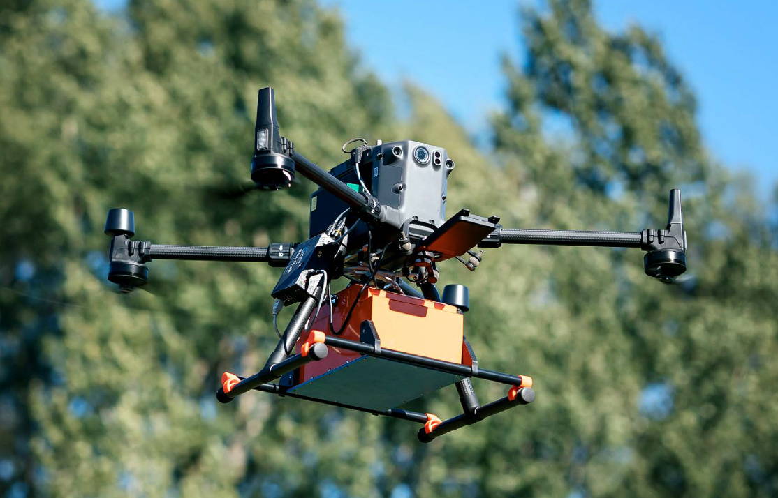
These drones are typically used to collect aerial data or to assist in launching smaller surface drones. They can also be equipped with LiDAR sensors or photogrammetry systems to map the water surface. For example, the DJI M350 RTK, can be outfitted with devices like the EchoLogger ECT D052S, a high-performance dual-frequency echo sounder that measures water depths between 0.5 to 200 meters. This echo sounder comes equipped with tilt and temperature sensors and features an RS232 interface, allowing easy integration with drones. Its lightweight and durable design make it ideal for deployment in challenging environments, offering accurate underwater data collection for small to large-scale water bodies. The echo sounder provides a versatile, efficient solution for detailed underwater mapping without the need for traditional manned vessels.
Oct 03, 2024
The DJI Matrice 30T is engineered to excel in a variety of demanding environments, offering a suite of advanced features tailored for professionals in fields such as public safety, inspection, and search and rescue. Below, we’ll explore the top features of the Matrice 30T and how they are applied in real-world scenarios.

1. Advanced Multi-Sensor Payload

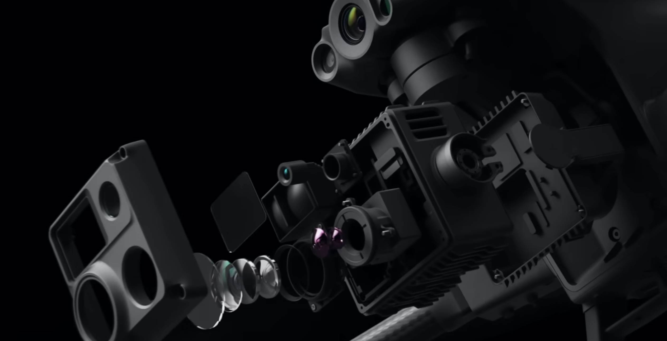
 48MP Zoom Camera: Captures detailed images with a 1/2" CMOS sensor.
• 12MP Wide Camera: Provides a broad field of view with a 1/2" CMOS sensor.
• Laser Rangefinder: Measures distances up to 1,200 meters.
• 640x512 Thermal Camera: Equipped with an uncooled VOx Microbolometer, offering a 30 Hz refresh rate.

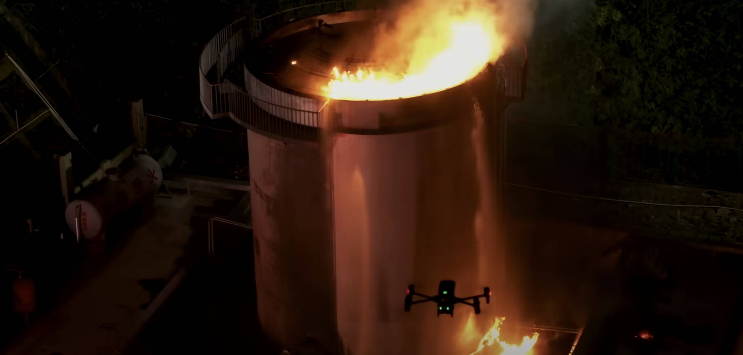
The high-resolution thermal camera of the DJI Matrice 30T proves valuable in search and rescue missions, particularly in low-visibility conditions such as night operations or dense smoke, allowing operators to locate individuals rapidly. Its zoom and wide-angle cameras further enhance the ability to pinpoint exact locations and assess situations from a safe distance. When it comes to thermal inspections, the zoom camera is essential for detailed inspections of high or hard-to-reach structures, like bridges and power lines, while the integrated laser rangefinder accurately measures and documents distances and dimensions during infrastructure inspections.

2. Exceptional Flight Performance

• 41 Minutes of Flight Time: Provides extended operational periods.
• Wind Resistance: Capable of withstanding winds up to 15 m/s.
• Maximum Speed: 23 m/s for quick coverage.
• Service Ceiling: Up to 4,000 meters.

The extended flight time of the DJI Matrice 30T enables prolonged monitoring of large areas, minimizing the need for frequent recharging, which is crucial for tracking animal movements and observing environmental changes. In emergency response situations, the drone's ability to operate in strong winds and extreme temperatures ensures reliable performance, making it ideal for rapid deployment in adverse weather conditions.

3. Enhanced Transmission System

• 15 km Transmission Range: Ensures long-distance control and video feed.
• Triple-Channel 1080p Video: High-definition streaming in real-time.
• Real-Time Auto-Switching: Automatically switches between 2.4 GHz and 5.8 GHz.
• AES-256 Encryption: Provides secure data transmission.

The long transmission range and high-definition video feed of the DJI Matrice 30T make it perfect for monitoring and streaming live footage of large-scale public events from a significant distance. Additionally, its secure data transmission ensures that sensitive information gathered during critical infrastructure inspections or surveillance is protected, a crucial feature for sectors like utilities and government facilities.

4. Powerful Vision System

• 6 Directional Sensing and Positioning: Dual-vision and ToF sensors on all six sides.
• Detection Range: Up to 40 meters.

The DJI Matrice 30T’s advanced sensing system is especially beneficial for inspection tasks in complex environments like industrial facilities or dense urban areas. Its thermal camera can detect heat signatures from malfunctioning equipment or electrical faults, while the obstacle detection system ensures safe navigation around tight spaces or high structures. This makes the Matrice 30T ideal for inspecting critical infrastructure such as power plants, refineries, and utilities, where identifying potential issues before they escalate is crucial for maintaining operational efficiency and safety.

5. Innovative Remote Control (DJI RC Plus)

• 7-Inch Touch Screen: Clear, real-time display.
• IP54 Rating: Weather-resistant.
• Integrated Cellular Module: Supports 4G for network integration.
• Battery Life: Up to 6 hours of continuous operation with hot-swapping capabilities.

The DJI Matrice 30T's weather-resistant design and extended battery life allow operators to perform field operations in challenging conditions and carry out long-duration missions without interruptions. Additionally, the integrated cellular module supports real-time data upload and analysis, making it highly effective for operations that require immediate access to data or remote coordination, ensuring timely decision-making and efficient workflow management.

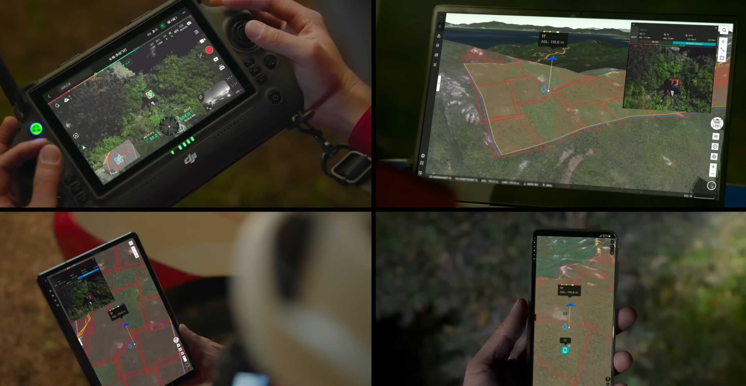
6. Streamlined Mission Management with FlightHub 2

FlightHub 2 creates seamless ground-to-cloud synergy, enabling efficient mission management with features like a 2.5D Base Map for terrain awareness, One-Tap Panorama Sync for rapid overviews, and Cloud Mapping for quick RGB or infrared mapping. It supports mission live streaming, connecting multiple users to simultaneous drone operations with low-latency, high-resolution video. Live annotations allow teams to highlight areas of interest for improved collaboration, while streamlined communication synchronizes critical information like team positions and drone status in real time. Advanced tools, including route planning and smart inspection, further enhance mission efficiency and data management.

RELATED POSTS

Oct 03, 2024
Ground Penetrating Radar (GPR) technology has transformed how we explore and understand what's beneath the surface, making it an essential tool in fields like archaeology, construction, and environmental monitoring. When choosing the right GPR system, several factors come into play, including the depth of investigation, the size of the equipment, the frequency of the radar, and its compatibility with drones or terrestrial surveys. In this blog, we'll explore some key considerations when choosing a GPR system and highlight three options from SPH Engineering's Radar Systems: the Zond Aero 1000, Zond Aero 500, and Zond Aero LF.

How GPR works

Ground-penetrating radar (GPR) operates by sending radar pulses into the ground to detect and image underground objects and structures. The GPR transmitter emits electromagnetic energy, which travels through the soil. When this energy encounters an object or a boundary between materials with differing dielectric permittivity (a property that affects the speed of electromagnetic waves), part of the signal is reflected back to the GPR's receiving antenna. The system’s electronics then capture and record these variations, creating a detailed image of the subsurface.

Key Factors to Consider When Choosing a GPR

Frequency and Depth Penetration

The center frequency of the GPR antenna determines how deep the radar waves will penetrate and the resolution of the data. Lower frequencies penetrate deeper but offer lower resolution, while higher frequencies provide more detailed images but are limited to shallower depths.

Weight and Portability

Depending on your fieldwork conditions, the weight of the GPR system may be critical. If you're using a drone for aerial surveys, you'll want to ensure that the GPR is lightweight and can be mounted securely on the drone. Alternatively, for ground surveys, portability and ease of transportation are important.

Environmental Resistance

GPR systems are often deployed in challenging environmental conditions. Ensuring that the system is durable and resistant to factors like extreme temperatures, humidity, and dust can extend the life of the equipment and ensure reliable performance in harsh environments.

Integration with Drones

As drone technology advances, many GPR systems are now designed to be mounted on various drones, enabling faster and more efficient data collection over large areas. Compatibility with drones such as the DJI M350 RTK or M300 RTK is essential for those considering aerial surveys.

Data Processing and Formats

The data collected by GPR systems must be processed and analyzed to produce useful results. It's important to consider the software included with the GPR system and the format in which the data is provided, especially if you'll be integrating the data with other geophysical tools.

SPH Engineering's Radar Systems GPR Options

Zond Aero 1000

The Zond Aero 1000 is a high-frequency GPR system designed for shallow, high-resolution surveys. Ideal for aerial drone surveys, it is equipped with a 1000 MHz antenna, making it suitable for applications requiring fine detail within the upper layers of the subsurface.
Key Features:

• Frequency: 1000 MHz, with an operating bandwidth of 600-1300 MHz.
• Depth: Up to 2 meters, depending on ground properties.
• Weight: 1.7 kg in airborne configuration.
• Compatibility: DJI M300 RTK, M600 Pro drones.
• Data Output: 16-bit digital raw data in SEGY format.
• Operating Conditions: -20°C to 60°C, IP68 ingress protection (in a protective box).
• The Zond Aero 1000 is an excellent choice for high-detail surveys in areas where shallow penetration is acceptable, such as archeological sites, utility detection, or shallow environmental studies.
The Zond Aero 1000 GPR system flying at an altitude of 0.6 meters over a sandy soil range. Known test targets were successfully detected, and in several profiles, the interface between the sand and the original underlying soil was clearly visible at a depth of 0.5 to 0.7 meters.

Zond Aero 500

A versatile mid-frequency system, the Zond Aero 500 is suited for both aerial and ground surveys. With a 500 MHz antenna, it strikes a balance between penetration depth and resolution, making it a go-to option for a wide variety of survey types.
Key Features:

• Frequency: 500 MHz, with an operating bandwidth of 200-900 MHz.
• Depth: Up to 4 meters in average normal soil.
• Weight: 2.1 kg in airborne configuration.
•  Compatibility: DJI M300 RTK, M600 Pro drones.
• Data Output: 16-bit digital raw data in SEGY format.
• Operating Conditions: -20°C to 60°C, IP68 ingress protection (in a protective box).

The Zond Aero 500 is a versatile choice for users needing more penetration depth while maintaining resolution, ideal for construction, environmental surveys, and utility mapping.

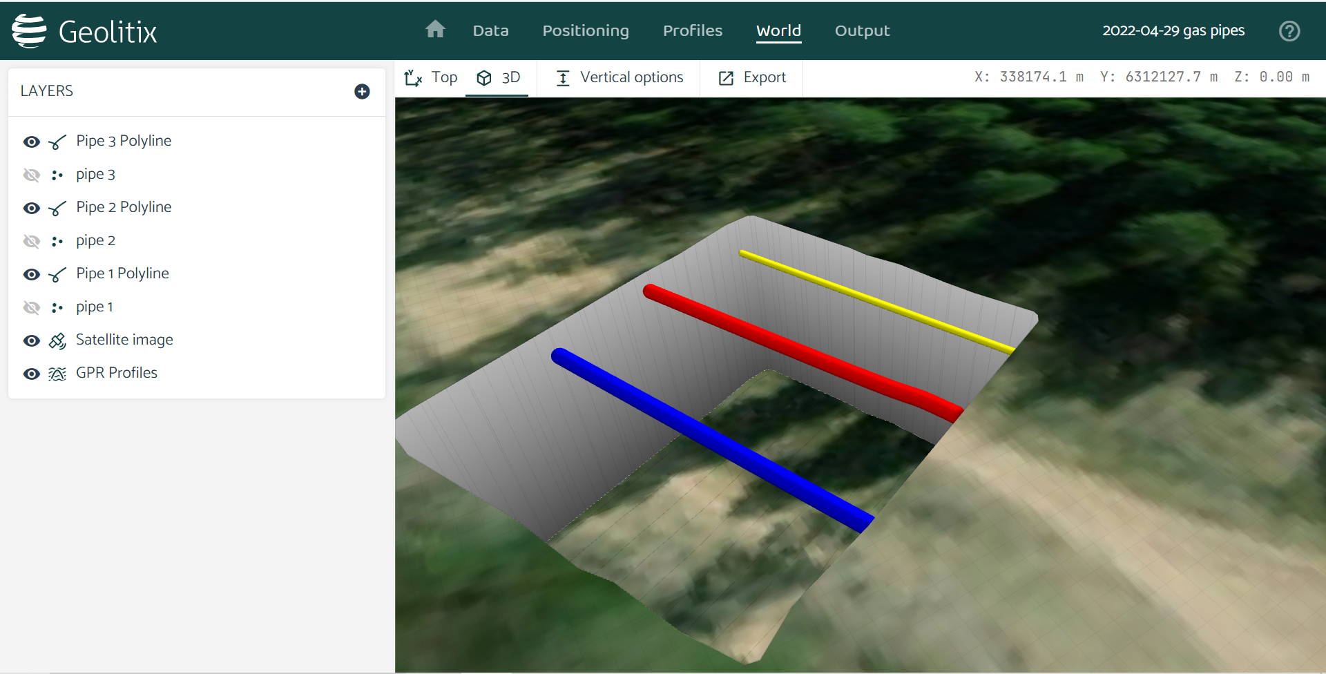
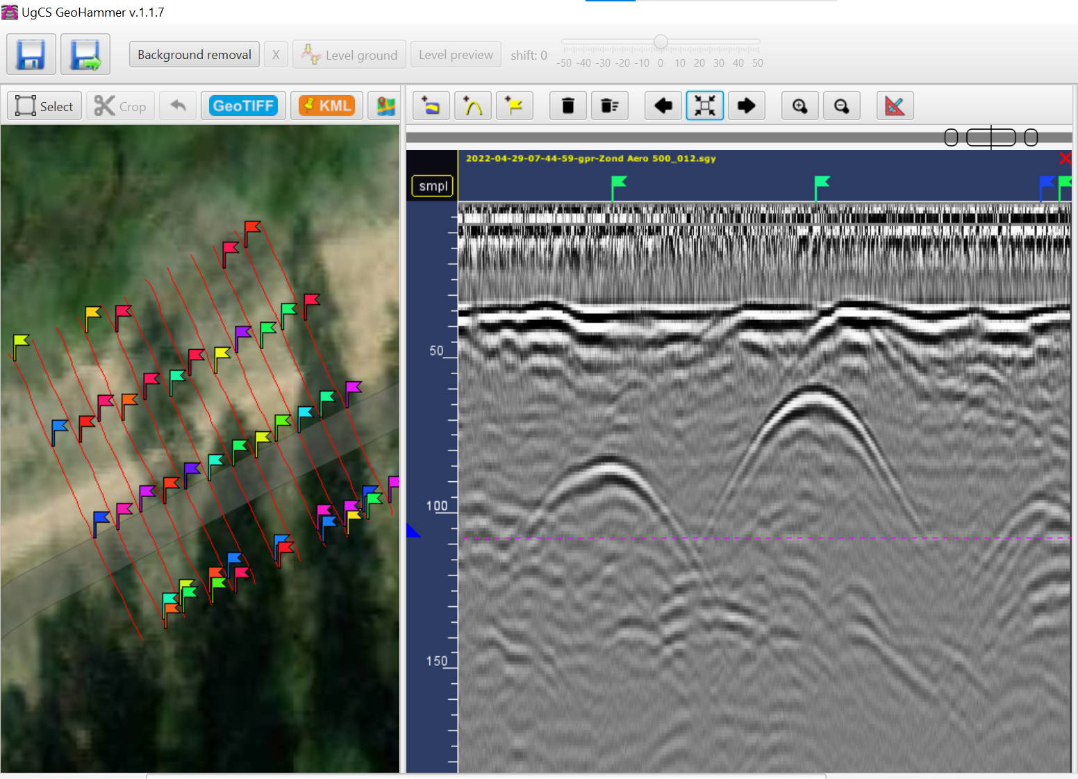
Zond Aero 500 data with gas pipelines. Drone: DJI M300 RTK. Drone equipped with UgCS SkyHub onboard computer and terrain following system. Flight altitude: 2m AGL. Flight speed: 1m/s

Discover the Zond Aero 500 NG

"NG" in the context of SPH Engineering refers to Real-Time Sampling (RTS) technology, featuring a high-performance, FPGA-based controller used across all models. This advanced system enables high hardware stacking, offering sample rates of up to 1,280,000 samples per second and scan rates of up to 2,500 scans per second, depending on the hardware configuration. It provides 32-bit digital raw data output with time ranges per sample as low as 71 picoseconds. The technology represents significant advancements in real-time data collection and processing.

Zond Aero LF (Low Frequency)

The Zond Aero LF offers low-frequency options for deeper penetration surveys. It comes with three sets of dipoles for frequencies of 100 MHz, 150 MHz, and 300 MHz, making it highly adaptable for various survey needs. With its lightweight design and advanced Real-Time Sampling (RTS) technology, it is suitable for both airborne and ground surveys.
Key Features:

• Frequencies: 100 MHz, 150 MHz, and 300 MHz.
• Depth: Up to 12 meters in soil, depending on conditions.
• Weight: 0.8 kg (controller), 0.1 kg (300 MHz antenna), 0.2 kg (150 MHz antenna), 0.4 kg (100 MHz antenna).
• Compatibility: DJI M300 RTK, M600 Pro drones.
• Data Output: 32-bit digital raw data in SEGY format.
• Operating Conditions: -20°C to 60°C, IP68 ingress protection (in a protective box).

This system is perfect for applications requiring deeper penetration, such as geological surveys, environmental monitoring, or detecting large underground objects like pipes and voids.
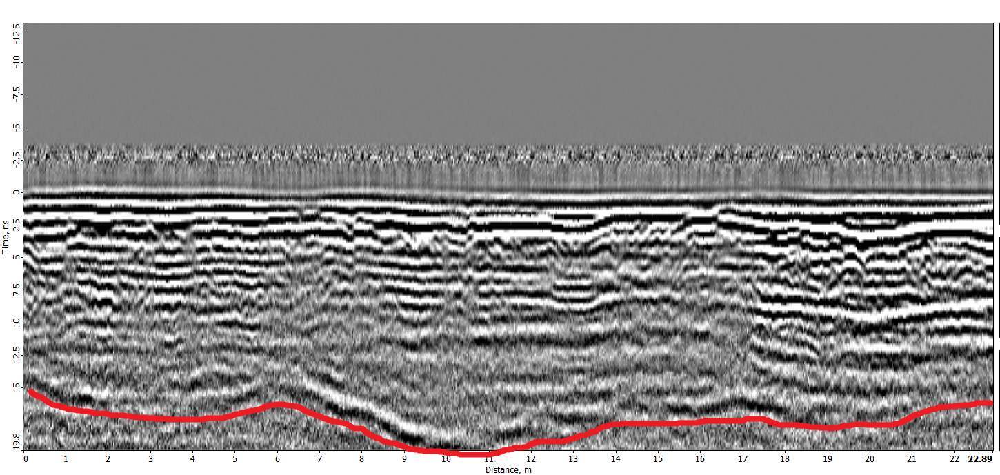
Zond Aero LF data with gas pipelines. Drone: DJI M300 RTK. Drone equipped with UgCS SkyHub onboard computer and terrain following system. Flight altitude: 2m AGL
Flight speed: 1m/s

Summary: Comparing the GPR Systems

Feature Zond Aero 1000 Zond Aero 500 Zond Aero LF
Center Frequency 1000 MHz 500 MHz 100, 150, 300 MHz
Max Depth 2 meters 4 meters Up to 12 meters
Weight (Airborne) 1.8 kg 2.1 kg 0.1 kg – 300MHz antenna
Drone Compatibility DJI M350 RTK, M300 RTK, and more DJI M350 RTK, M300 RTK, and more DJI M350 RTK, M300 RTK, and more
Data Format SEGY (.sgy) SEGY (.sgy) SEGY (.sgy)
Best For Shallow, high-res surveys Mid-depth, versatile surveys Deep surveys, geological applications

RELATED POSTS

Oct 03, 2024
BACK TO TOP