[Webinar] ScoutDI: Revolutionizing Confined Space UTM Inspections. Register Now

Call Us: +1 866 300 9012

contact@measur.ca

Call Us: +1 866 300 9012

contact@measur.ca
SHOPPING CART

No Products in the Cart

TOTAL:
$0.00

QUANTUM SYSTEMS TRINITY F90+

PPK combined with the advantages of an eVTOL fixed-wing UAV with a class-leading flight time of more than 90 minutes and long range telemetry.

Over

90+

Minute Fly Time

Down To

0.7

cm/px GSD

Map Up To

700

Hectares @ 120 meters

Up To

7.5

Kilometre Range

Mapping Made Easy

The Trinity F90+ makes mapping easy by combining advanced VTOL technology with high-resolution imagery; all at an extremely competitive price point starting at just $28,550. With a multitude of payload options, the Trinity F90+ is perfect for mapping & surveying, agriculture, forestry, construction, and more! Learn about the latest Qube 240 LiDAR payload - the first survey-grade LiDAR sensor for a UAV of this weight.


Vertical Take-Off and Land


The Trinity F90+ takes-off and lands like a helicopter, but flies like a plane. Combining the handling of multi-rotor drone with the aerodynamics of an airplane, the Trinity F90+ does not need a runway or extra equipment to take-off or lad. The drone lands smoothly and controlled on its shock absorbing landing gear. This means reduced harm on the sUAS and sensors for an extended product life. 
How does VTOL increase drone survey success?
  • Take-off and land anywhere regardless of terrain
  • No belly landing
  • Easy and safe for the operator
  • Better payload protection
  • Ability to adapt to moving environment
  • Heavier cameras for higher image quality
  • Easy and Safe Handling

    A push of a button is enough and the UAV will do its assigned job. The remote control has a clean layout without confusing switches and levers. The Trinity F90+ and the remote controller work together seamlessly to get your job done automatically, while still providing emergency override capabilities.


    Thanks to Quantum’s sophisticated electric VTOL design your investment is never in danger due to a flawed hand launch or a rough belly landing.

  • Reliable and Integrated Design

    We designed the Trinity F90+ as a product that meets the requirements of professionals. We started from scratch with a highly integrated industrial product in mind.


    You can see the result in every detail, such as the optimized electric layout, the efficient cargo container or the clean finish of the outer shell. It truly showcases the best of German engineering.

  • Longest Flight Time in Class

    The ability to switch to gliding mode enables the Trinity F90+ to directly benefit from an enhanced long range capability. We dedicated many hours to optimize the wing geometry to push the glide ratio to an astounding 14:1!


    Using only one specially-designed motor in the rear fuselage increases the flight time far beyond current industrial UAVs by reducing energy consumption to a minimum.


  • Small Footprint

    The Trinity F90+ comes “ready to fly” (RTF) in a molded transport case which offers enough space for the whole package with room to add two optional battery packs, accessories, and a tablet PC.

    A padded cover with convenient carrying options makes it easy to transport the package to the farthest operation area. At a size of 100x83x27cm it can be stowed away easily.

More survey data in less time


The Trinity F90+ demonstrates its range advantage in comparison to rotary and other fixed-wing drones due to the longer flight time and covers up to 20 times larger areas. The larger the area to be covered, the more attractive the use of the Trinity F90+ gets.
The Trinity F90+ sets a new standard for high-accuracy survey equipment. Thanks to a high-end PPK GNSS L1/L2 receiver and full-frame mapping cameras, it is possibly for customers to achieve absolute accuracy down to 1 cm.
GCPs are no longer needed to get highly-accurate results. To verify your results’ accuracy, place as few as three on the field and use them as checkpoints.

Up To

45

MP Camera

Down To

1

Centimeter Absolute 

Newly Released

LiDAR

Integrated Payload

L1/L2

PPK

Integrated Receiver

Payloads

  • Easy payload swapping

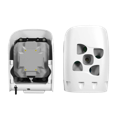
    Payloads can easily be swapped in seconds by using the QuickLock mechanism. No tools are required and the sensors are highly integrated to support the pilots’ mission planning. 

  • Payload damping

    All cameras are damped against in-flight vibrations to guarantee highest image quality.

  • No belly landings

    Rough landings should be avoided at any time. We rely on vertical take-off and landing to guarantee smooth landings and therefore a long service life. The landing gear keeps your payload safe.

  • Easy access to your data

    Access to the recorded data is uncomplicated via external card slots.

Video

Oblique D2M

4 oblique and one NADIR camera 

  • Five-lens RGB Camera
  • GSD at 1.50 cm @100m AGL
  • Cameras : 1 x NADIR, 4 x oblique
  • Resolution: 26 MP (6252 x 4168 px)

Video

Sony UMC-R10C

APS-C​ 20.1 MP camera

  • Orthophoto & DEM
  • point clouds & 3D models
  • 2.1cm/px @ 100m altitude
  • 16 mm & 20 mm lens option

Video

RedEdge-P

5 spectral band sensor

  • RGB at 3.98cm/px @120m altitude
  • multispectral for vegetation analysis
  • 1 flight => orthophoto (5 bands)
  • various indices for plant stress

Video

Sony RX1RII

Full-frame 42 MP camera

  • Orthophoto & DEM
  • point clouds & 3D models
  • 1.29cm/px @ 100m altitude

Video

Micasense Altum-PT

5 spectral bands & thermal sensor

  • RGB colour output 12.4 MP
  • multispectral data + thermal layer
  • 1 flight => orthophoto (6bands)
  • various indices for plant stress

Qube 240 LiDAR

The Qube 240 LiDAR is a survey-grade payload for the Trinity F90+ enabling over an hour of flight-time.

  • Suggested altitude: 100 m AGL
  • Precision: 1.8-2.5 cm*
  • Accuracy: < 3 cm**
  • Scanner field of view: 70°
  • 240,000 shots per second
  • Point density @100m: 50-100 points/m²
  • Multi-echo technology: up to 3 echoes

*Precision, also called reproducibility or repeatability, accounts for the variation in successive measurements taken on the same target. Depends on altitude AGL.

**Accuracy is the degree of conformity of a measured position to its actual (true) value

QBase 3d


Intuitive Mission Planning, Flight Monitoring, and Data-Post Processing
QBase 3D is the most convenient platform to plan aerial survey missions with Quantum-Systems UAS. It automatically generates efficient flight paths after the observation areas and the mission parameters have been defined with just a few clicks. This allows the operator to be up and flying within no-time, saving valuable resources. For advanced missions, the pilot is in complete control over the photogrammetric aerial survey mission and can adjust all relevant parameters to generate professional and optimum results.

During flight mode, QBase 3D provides accurate information on aircraft and mission status to ensure flight safety and mission success. After mission completion, QBase 3D enables processing of the captured images, precision enhancement with the built-in PPK solution and export of all metadata to file formats suitable for a variety of platforms for further post-processing. 
  • Fully Autonomous Missions

  • Terrain Following

  • Corridor Mapping

  • Manual Take-Over

  • KML Import

  • Offline Maps

  • 3D Flight Planning

  • Integrated PPK Post-Processing

CONTACT US

Want to get in touch with us? Just fill out the form below and we'll get back to you ASAP.

BACK TO TOP