+1 866 300 9012   contact@measur.ca
SHOPPING CART

No Products in the Cart

TOTAL:
$0.00

Written by: Maria Zavarce

Contributor: Lukas Wilgosh 

End-of-Year Checklist for Commercial Drone Users

November 20, 2024

4 minutes read

As 2024 comes to an end, now is a great time to evaluate your commercial drone operations and plan for success in the year ahead. Whether you’re a seasoned operator or expanding your fleet, thoughtful preparation can set you up for a strong start to 2025. Here are key steps to take before the year wraps up.

1. Assess Your Current Drone Fleet

Take stock of your current drones. Are they meeting your needs in terms of performance, flight time, and compatibility with modern sensors?


Older drones may lack the features necessary for advanced operations. If your fleet isn’t keeping up with industry demands, it may be time to upgrade to newer models with advanced technologies like AI-assisted navigation or RTK precision.

2. Optimize Your Budget

If you have unused funds in this year’s budget, consider investing in essential upgrades, spare parts, or new equipment to avoid starting the new year under-equipped. Take advantage of Measur’s  year-end promotions, reach out today to learn more.


Plan for upcoming expenses, including maintenance, software subscriptions, and potential expansion. Allocate funds for increasingly popular technologies like LiDAR or multispectral sensors if they align with your future goals.

3. Ensure Regulatory Compliance

Drone laws evolve frequently. Check for any changes in regulations that might impact your operations, such as new altitude limits, flight restrictions, or requirements for remote ID compliance.


Verify that all operators in your organization have up-to-date certifications and necessary training. Ensure compliance with national and local aviation authorities to avoid fines or operational delays.


Review your insurance policies to confirm adequate coverage for your fleet and operations, including liability and equipment damage.

4. Maintenance and Repairs

Before year-end, inspect your drones for any signs of wear, tear, or damage. Pay attention to rotors, batteries, sensors, and gimbals. Contact us for reliable maintenance and repair services to keep your equipment in top condition.


Prepare for potential downtime by stocking essential spare parts such as propellers, batteries, and cables. This is particularly important if you operate in remote locations or harsh conditions.

5. Update Technology and Software

Ensure that all drones and controllers are running the latest firmware. Updates often include critical bug fixes, enhanced features, and improved safety protocols.


Check if your software platforms for mapping, photogrammetry, or other applications are still compatible with your fleet. Consider upgrading or switching to software that offers better features, such as real-time processing or cloud-based data sharing.

6. Enhance Operational Efficiency

Look for ways to improve efficiency, such as integrating autonomous drones or automating data processing. Review your operational workflows to identify bottlenecks.


Offer additional training to your team on advanced equipment or emerging drone applications. Skilled operators improve efficiency and safety in the field.


Stay informed about new drone technologies, such as hybrid models, autonomous drones, or advanced payloads.

Get in Touch

Give us a call or drop by anytime, we will answer all enquiries within 24 hours on business days. We will be happy to answer your questions.

About the Author

Maria Zavarce, Marketing Coordinator at Measur, brings over two years of specialized experience in the drones and robotics industry. Combining her knowledge of emerging technologies with 8+ years of inbound marketing and SEO, she provides actionable insights into the transformative power of advanced solutions.

YOU MAY ALSO LIKE

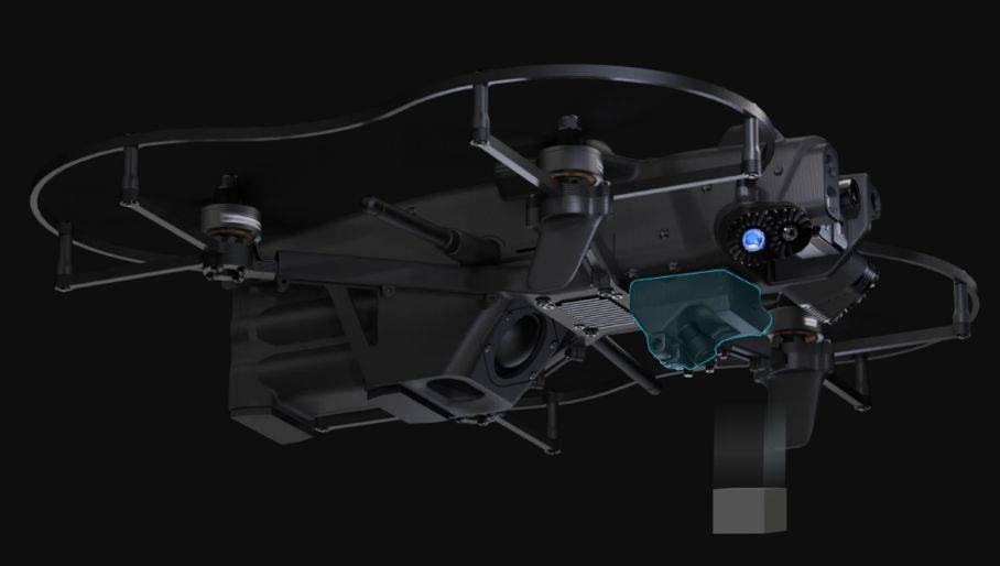
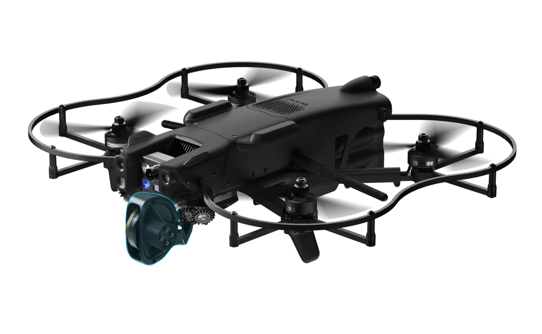
In life-threatening emergencies, responders are often faced with complex, unpredictable environments where every second counts. The BRINC Lemur 2  drone is designed to assist them in precisely these moments, entering the most hazardous situations to gather critical information, communicate with individuals on the ground, and deliver lifesaving tools. Combining advanced imaging, autonomous navigation, and rugged adaptability, the public safety drone offers a new level of situational awareness and control, ultimately helping save lives.
At the heart of the Lemur 2 is a powerful suite of sensors, optimized for visibility and data gathering in even the harshest conditions. Its 4K camera offers sharp, high-resolution footage during the day, ensuring that every detail in the surrounding environment is captured. But this public safety drone truly shines when light becomes scarce. With integrated night vision and thermal sensors, it cuts through the darkness and detects heat signatures, giving operators vital information when navigating tight, GPS-denied spaces such as collapsed buildings, smoke-filled rooms, or other low-visibility environments.

Real-Time Mapping with LiDAR

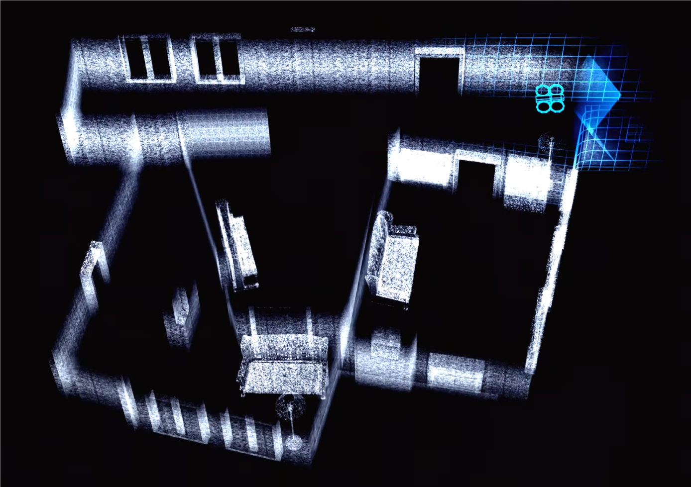
Time is of the essence in critical missions, and having an accurate map of your surroundings can make all the difference. The Lemur 2’s onboard LiDAR system offers real-time environmental scanning, generating live, precise 2D floor plans as it moves.

With over 570,000 data points collected per second, the drone builds a comprehensive map of even the most cluttered or challenging environments. This real-time mapping capability not only enhances visibility for remote operators but also supports teams working on the ground, helping them strategize their next move with accurate, up-to-the-second data.

In a collapsed building scenario, for instance, the drone’s LiDAR data can reveal blocked passageways or the safest path forward, saving lives by streamlining search and rescue efforts.

Autonomy and Control

Navigating tight, complex spaces is one of the greatest challenges for any unmanned aerial vehicle, but the Lemur 2 takes this in stride. Its dynamic autonomy system includes obstacle awareness and Smart Speed, a feature that automatically slows the drone as it approaches objects. Whether flying through narrow hallways, cluttered rooms, or multi-story buildings, the Lemur 2 maintains precision control, reducing the risk of collisions.

This intelligent navigation is crucial for drones for law enforcement in hostage situations, where the drone needs to enter buildings discreetly or in disaster areas where responders face multiple hazards.

Breaking Barriers with the Glass Breaker

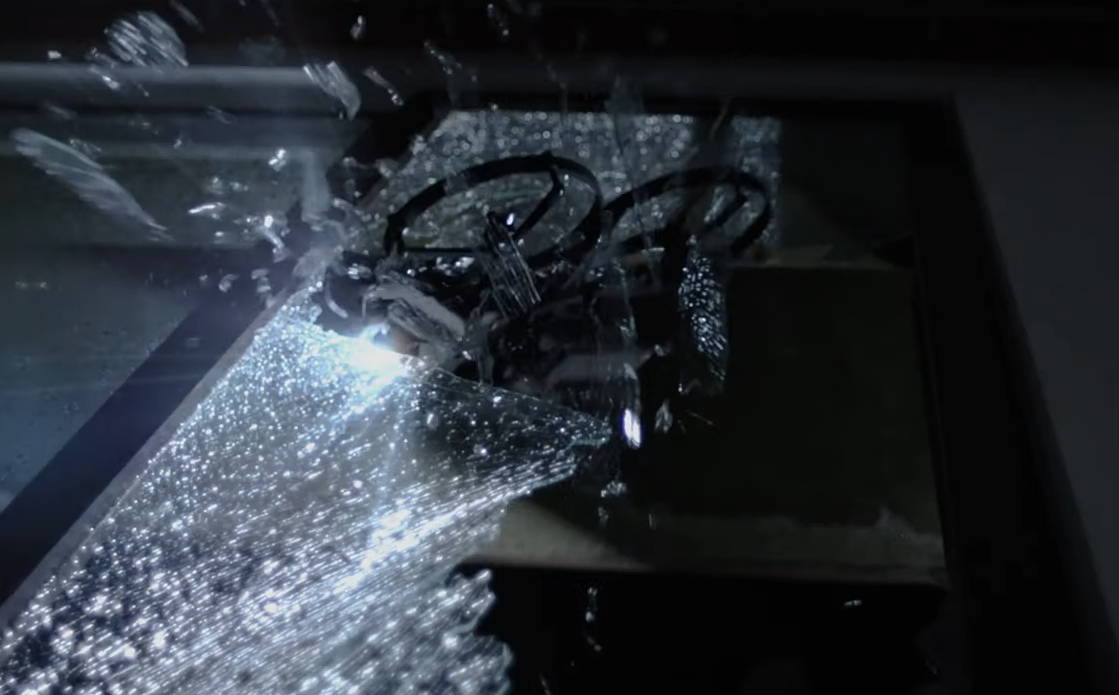
For law enforcement and emergency responders, gaining rapid entry into secured or inaccessible spaces is often critical. That’s where the Lemur 2’s glass breaker attachment proves its value. Capable of shattering tempered, automotive, and most residential glass, this tool enables responders to breach windows quickly and safely, providing access to trapped individuals or creating openings for ventilation during fires.

In an active shooter situation, for example, the ability to break through windows without putting personnel at risk allows law enforcement to gather crucial intelligence and take action from a safe distance.

Delivering Essentials

The Lemur 2’s multipurpose dropper, capable of carrying and delivering payloads of up to 1 pound, offers another layer of functionality. From delivering medical supplies to victims trapped inside a building, to sending negotiator phones into high-risk environments, the dropper provides tactical solutions without requiring direct human involvement. This "last inch" delivery system ensures that essential tools or aid reach their destination, even when the situation is too dangerous for people to approach directly.

In scenarios where even opening a door could pose a significant risk, this capability keeps first responders out of harm's way while still accomplishing critical tasks.

Built to Survive Harsh Conditions

Designed for durability, the Lemur 2 can handle tough conditions. Its IP24 rating means it's protected against water and dust, allowing it to perform reliably in environments where other drones might struggle. Additionally, its advanced AES-256 encryption ensures that all communications remain secure, preventing unauthorized access to sensitive information.

This combination of rugged features makes the Lemur 2 a versatile tool, whether deployed in a flood zone, a fire, or a high-security situation. It’s built to work in the most demanding conditions, keeping responders informed and protected at all times.

A Future of Safer Operations

The Lemur 2 represents the future of public safety drones. By combining cutting-edge technology with practical, lifesaving features, it enhances the capabilities of first responders and law enforcement agencies worldwide. Flying through smoke, navigating collapsed buildings, or delivering vital supplies, the Lemur 2 redefines efficiency and safety in dangerous environments. It’s a game-changer, designed to access areas others can’t, providing essential support to help save lives.

RELATED POSTS

Oct 22, 2024
October 7th, 2024 - Measur, Canada's leading unmanned systems distributor, and BRINC Drones, a leader in public safety technology, today announced a strategic partnership to bring BRINC's range of uncrewed technology manufactured in the USA, to public safety agencies across Canada. This partnership will expand the availability of BRINC's advanced public safety solutions, including the Responder, Station, Lemur 2, and BRINC Ball across Canada. By working together, Measur and BRINC Drones aim to enhance public safety and provide first responders in Canada with the cutting-edge technology they need to excel in their missions.
Headquartered in Seattle, Washington, BRINC Drones is at the forefront of innovation in public safety technology. BRINC Drones offers a range of advanced products designed to enhance situational awareness, streamline emergency operations, and facilitate effective communication in high-stress environments. Their innovative solutions, including the Responder, Lemur 2, BRINC Station, and BRINC Ball, are tailored to meet the rigorous demands of first responders and public safety agencies. With features like real-time thermal imaging, LiDAR mapping, rapid deployment capabilities, and durable communication systems, BRINC Drones equips emergency teams with the essential tools to make informed decisions and perform critical missions accurately and efficiently.
“BRINC is excited to partner with Measur to bring BRINC’s cutting-edge technology to agencies across Canada,” said Andrew Coté, Vice President of Strategy and Growth at BRINC. “This partnership expands the reach of our purpose-built for public safety technology and provides Canadian first responders with critical tools to enhance situational awareness and improve response times. Together with Measur, we look forward to supporting public safety efforts and increasing the visibility of BRINC products across Canada.”

BRINC Responder

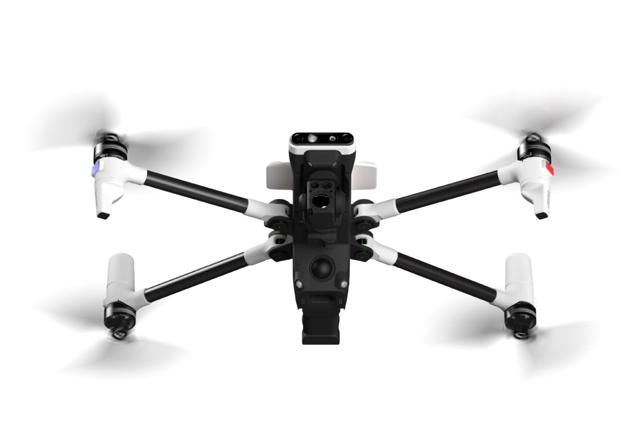
BRINC’s Responder drone is the world’s first purpose-built 911 response drone. It offers exceptional situational awareness with a 640px resolution thermal camera, 40X total zoom, and rapid deployment features. It integrates with the BRINC ecosystem for advanced capabilities in emergency response.

BRINC Station

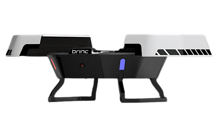
A cutting-edge drone charging nest that ensures rapid deployment of Responder in under 5 seconds. The station is engineered for reliability and durability, with features like fast charging, climate control, and compatibility with Starlink and solar panels.

Lemur 2

A versatile drone designed for indoor tactical environments, equipped with 4K daytime, night vision, thermal sensors, and real-time LiDAR mapping. The Lemur 2 also features dynamic autonomy and advanced obstacle detection for superior navigation and safety.

BRINC Ball

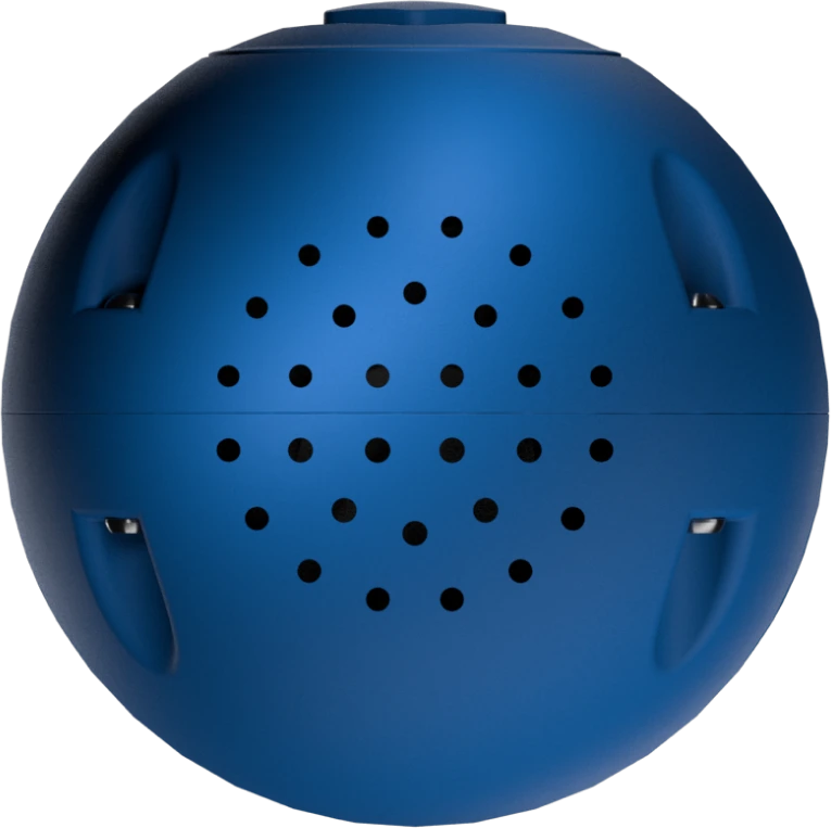
An innovative communication device designed for high-stakes situations, featuring a sensitive microphone, 4G/LTE connectivity, and powerful speakers, ensuring clear and reliable communication in any environment.
"We have seen an increase in demand from our public safety partners across Canada for USA-manufactured uncrewed technology that is capable, affordable, and accessible. The BRINC ecosystem between hardware, like the Lemur 2 for indoor tactical operations or the Responder for outdoor response, and LiveOps software creates an industry-first all-in-one operations platform that unifies drone operations for public safety professionals. We are extremely excited to introduce BRINC's turnkey drone program for public safety and emergency responders across Canada.” said Lukas Wilgosh, Vice President - Unmanned Technologies at Measur.
Starting today, all BRINC Drones products are available for sale by Measur including the Responder, Lemur 2, Station,Ball, and LiveOps software. Measur will provide local support and service to BRINC operators in all of our service locations across Canada. 
About BRINC Drones
BRINC is an American developer of technology in the service of public safety. The company builds a connected ecosystem of tools designed to save lives. BRINC manufactures its products in the US, has co-located R&D and production, and is vertically integrated, controlling the entirety of its supply chain. Over 500 public safety agencies and 10%+ of the SWAT teams in the US use its products to de-escalate dangerous situations and safeguard human life. The company is backed by top investors, including Sam Altman, Index Ventures, Dylan Field, Elad Gil, Patrick Shanahan, Julius Genachowski, Shyam Sankar, Alexandr Wang, Bradley Tusk and Jeff Weiner.
For more information, visit: brincdrones.com
About Measur
Measur is Canada's commercial drone experts. Founded in 2001, Measur has become the most trusted source for aerial solutions in mining & aggregates, agriculture & forestry, infrastructure & utilities, construction, surveying & mapping and oil & gas.
Learn more: drones.measur.ca

RELATED POSTS

Oct 07, 2024
Bathymetric surveys, which involve mapping the underwater topography of lakes, rivers, oceans, and other bodies of water, have historically been conducted using traditional manned boats equipped with sonar systems. While effective, these methods can be time-consuming, expensive, and sometimes risky, especially in shallow, remote, or hazardous waters. However, drones or unmanned aerial vehicles (UAVs) and unmanned surface vessels (USVs) are facilitating bathymetric surveys by offering a faster, more efficient, and safer alternative.

What is a bathymetric survey?

A bathymetric survey measures the depth and topography of the underwater surface, providing a detailed map of the waterbed. These surveys are essential for a variety of industries, including environmental monitoring, coastal engineering, underwater construction, and scientific research. Traditional methods often rely on echo sounders mounted on boats or ships, but drones now offer new possibilities for bathymetric data collection.

Types of Drones Used for Bathymetric Surveys

There are two primary types of drones used in bathymetric surveys, Aerial Drones (UAVs) and Surface Drones or USVs:

Aerial Drones (UAVs)

Drone-Based Echo Sounder
EchoLogger ECT D052S Echo Sounder
These drones are typically used to collect aerial data or to assist in launching smaller surface drones. They can also be equipped with LiDAR sensors or photogrammetry systems to map the water surface. For example, the DJI M350 RTK, can be outfitted with devices like the EchoLogger ECT D052S, a high-performance dual-frequency echo sounder that measures water depths between 0.5 to 200 meters. This echo sounder comes equipped with tilt and temperature sensors and features an RS232 interface, allowing easy integration with drones. Its lightweight and durable design make it ideal for deployment in challenging environments, offering accurate underwater data collection for small to large-scale water bodies. The echo sounder provides a versatile, efficient solution for detailed underwater mapping without the need for traditional manned vessels.
Oct 03, 2024
BACK TO TOP