No Products in the Cart
Call Us: +1 866 300 9012
contact@measur.caGlobal mining companies are leveraging the power of drones in their mining operations; from exploration and drilling to blasting and reclamation, drones have become indispensable tools, streamlining processes and maximizing efficiency at every stage of a mine site. They provide valuable insight into slope stability, stockpile measurements and tailing monitoring. In underground and confined space environments, specially-designed drones conduct quick and cost-effective inspections to detect faults and areas of concern before they turn into costly problems.
Choose the right drone for your mining operations by considering the information below.

Longer flight times allow drones to cover larger areas or complete more tasks in a single flight, reducing downtime for battery changes.
Depending on the size of the mining site and the tasks involved, longer flight times present a greater benefit.

Consider the flexibility to integrate different sensors as the needs of the mining operation evolve.
This could include high-resolution cameras, LiDAR, magnetometers, echo-sounders or other specialized sensors.

The software used for processing data can significantly impact the usefulness of the information.
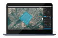
Ensure compatibility with data analysis software for tasks such as 3D mapping, volumetric analysis, and change detection.

The choice between fixed-wing and multirotor drones depends on the specific mining tasks.
Fixed-wing drones are more efficient for large area mapping, while multirotors excel in hovering and close-quarters inspections.
Find the perfect solution for your needs.

Drones significantly reduce the time required for surveys, allowing mining companies to quickly assess the terrain, monitor changes over time, and make informed decisions more efficiently.

Drones equipped with high-resolution cameras, LiDAR, or other sensors can rapidly map large mining sites. They provide accurate and up-to-date geospatial data, helping mining companies create detailed maps.

Regular drone-based assessments of stockpiles can be conducted more frequently and with greater accuracy than traditional methods. This ensures that mining companies have up-to-date information on the quantity and quality of materials.

Drones can be deployed for routine inspections of mining infrastructure, confined spaces, equipment, conveyors, and tailings dams. This minimizes the need for personnel to enter hazardous areas, improving overall safety conditions for workers.
Drone-based inspections provide a cost-effective solution. By eliminating the need for extensive manpower and heavy equipment, savings can be achieved in terms of personnel and machinery costs. Additionally, the early detection of asset issues through drone inspections prevents costly equipment breakdowns or production delays, ultimately saving mining companies substantial amounts of money.


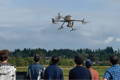
Drone-based confined space inspections, performed by ASIO Pro, enhance safety by eliminating the need for physical entry. With up to 24 minutes of flight time, these inspections are efficient, covering larger areas and reducing downtime. Advanced technologies like true 4K and infrared imagery provide detailed and accurate data for structural analysis. ASIO's stability and control in GPS-denied environments make it suitable for challenging conditions. Lightweight design and low noise levels contribute to a safer workplace environment. ASIO's adaptability spans industries, from construction to oil and gas, due to its ability to access hard-to-reach or hazardous spaces. Overall, drone-based inspections offer a revolutionary solution combining safety, efficiency, and advanced technology.

With high-resolution cameras and advanced sensors, drones capture detailed aerial imagery, providing accurate topographic and volumetric data. This technology enhances efficiency, safety, and precision in monitoring terrain changes and planning excavation activities, making it a cost-effective solution for open pit surveying.
The Trinity Pro drone, equipped with the Qube 240 LiDAR or the Oblique D2Mimaging system, revolutionizes mine wall mapping for 3D recreation. With advanced features like VTOL capability, extended flight time, and Quantum-Skynode autopilot, it ensures safe and efficient operations in challenging terrains.
The Qube 240 LiDARprovides precise topographic data with a point density of 50-100 points/m², while the Oblique D2M captures high-resolution images for detailed 3D modelling. Both payloads offer a comprehensive solution for accurate and efficient mapping of open pits in mining environments.

YellowScan aerial LiDAR systems provide a comprehensive lineup for high-accuracy lidar data in surveying and mapping open pits. The Mapper+ achieves a precision of 2.5 cm and an accuracy of 3 cm, while the Explorer and Voyager, designed for manned and unmanned aircraft, showcase remarkable precision at 2.6 cm and 0.5 cm, respectively.
The Matrice 350 RTK enhances stockpile calculations by facilitating efficient aerial surveys with high-precision sensors like the DJI Zenmuse P1 for photogrammetry and the DJI Zenmuse L2 LiDAR sensor. This drone automates data collection, reducing survey time significantly compared to manual methods. Integrated with DJI Terra mapping software, it creates detailed 2D maps and 3D models for accurate stockpile measurements. The Matrice 350 RTK's precision and reliability contribute to improved inventory oversight, enabling better supply chain logistics, detailed forecasts, and reduced write-offs. Overall, its advanced technology streamlines stockpile management, making it safer, more efficient, and cost-effective than traditional approaches.

Equipped with sensors, drones perform tasks up to 10 times faster, 70% cheaper, and with less risk than traditional methods.
SPH Engineering's comprehensive solutions cater to various mining phases, including prospecting, surveying, exploration, excavation, and recovery. Integrated systems, compatible with drones like DJI M350 RTK, enhance efficiency. Solutions include sensors such as magnetometers, GPR, and Echo sounders. These technologies streamline tasks like detecting underground infrastructure, identifying ore bodies, monitoring blast areasand real-time site monitoring.
Ground Penetrating Radar (GPR) is employed for tramp metal detection, ensuring the identification of metallic anomalies in mining areas. Additionally, the use of an echosounder and water sampler proves beneficial for waste ponds, allowing for depth profiling and water sampling to meet environmental requirements.


Whether you need one-on-one or group training, our training programs provide the latest practical knowledge while keeping your budget in mind.
Looking to rent a drone to meet your evolving drone needs?
You'll find a wide range of industry-leading equipment, from DJI drones to advanced LiDAR systems at Measur. We offer cost-effective and convenient solutions for accessing high-quality drone technology without the commitment of ownership.
Give us a call or drop by anytime, we will answer all enquiries within 24 hours on business days. We will be happy to answer your questions.
We would love to hear from you! Our team is always here to help.
+1 866 300 9012
contact@measur.ca
Vancouver, British Columbia
Calgary, Alberta
Mississauga, Ontario
Montreal, Quebec